• Home
  • Oil and Gas
  • Geotechnical
  • More
    • Home
    • Oil and Gas
    • Geotechnical
  • Home
  • Oil and Gas
  • Geotechnical
SUBSURFACE IMAGING CO. LTD.

Industrial and Geotechnical Services

Landslide Hazard Mapping and Investigation - Regional and Site

  • Regional landslide studies incorporating geological, geomorphological, geotechnical data and Geographical Information System (GIS)

Mining assessment - Open Pit and Subsurface Evaluations

Ground Penetrating Radar Investigation   

  • Subsurface utilities infrastructure, water leakage, road tarmac/pavement mapping and assessment
  • Shallow geologic hazard mapping, underground storage tanks 
  • Bridge infrastructure 

Aerial Drone 3D Mapping and LIDAR-based geotechnical data analysis

GPR slice of road tarmac and pavement infrastructure to identify intrusion features

GPR mapping using GPS based system for  locating  underground structures

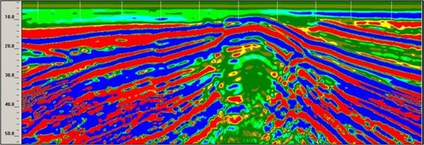
Investigation of subsidence in unstable soil for geotechnical investigation analysis

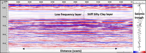
 Investigation of subsidence beneath crude oil storage tank for geotechnical analysis

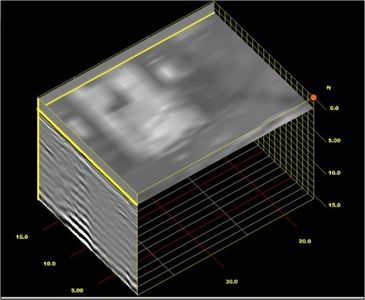
3D GPR underground storage tank infrastructure mapping 

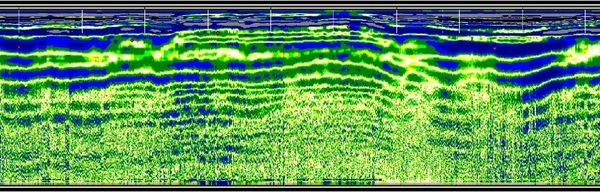
Subsurface investigation for channel definition in shallow river depositional systems 


Contact : stanley.wharton@subsurface-imaging.com

                 www.subsurface-imaging.com